the distance from Cape Breton NS to Tofino BC - would look like projected on
the terrestial globe at the equator. Not surprisingly, it is rather modest: roughly the
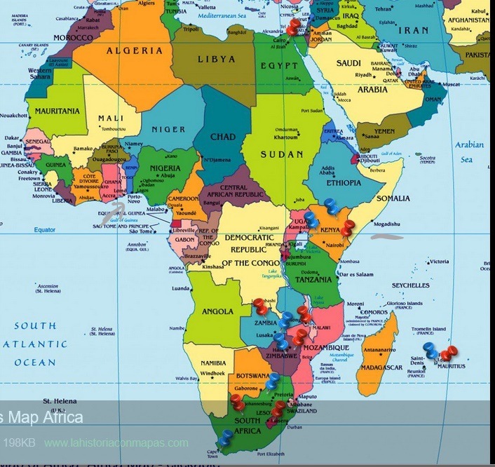
distance between Mogadishu Somalia, and Lagos Nigeria. My calculations so far:
Pretty rough, I am working from the globe as a perfect sphere. Not that there aren't
moult models of the reality, indeed there are too many. But at this point, just wanted
a rough estimation.
Chose the 49th parallel as the place to measure because - famously - it defines the
border between Canada and the US from BC to Manitoba. Personally, I live in the
southerly St-Lawrence basin, at the 45th.
For a perfect sphere, 49 degrees or .855 radians, has a cosine value of .6561...That
means that the radius of a circle - our 49th parallel - would be that proportion of the
circumference of the circle, or earth. The earth comes in at 40 007.86km so the 49th
would be 26 405km. And the longitude difference between Tofino and Cape Breton
being 65 degrees, the national waistline is .18 x 26406 = 4 841 km. Which is roughly
the distance between Mogadishu and Lagos.
The actual figures will be different when I get them, but we have an idea..
* * *
In point of fact, the dimension of these parallels is known. Below, from Wikipedia.
50 degrees is at 25 810, so 49 might be 26 300...

No comments:
Post a Comment